
Understanding the Role of London Land Surveyors
Land surveying is a critical element in the planning and execution of construction projects. In bustling urban environments like London, understanding the terrain and existing structures is vital for successful development. London land surveyors play an indispensable role in ensuring that every aspect of a site is accurately measured, reported, and considered in the planning phase. This article delves into the essential functions of these professional surveyors and provides insights into the importance of topographical surveys.
What Is a Topographical Survey?
A topographical survey, commonly referred to as a land survey, is a detailed mapping of the features of a parcel of land, including both natural and man-made elements. This specialized survey captures data on slopes, elevations, trees, buildings, infrastructure, and other significant features of the land. The outcome is a detailed plan that architects, engineers, and planners use to make informed decisions regarding land development and construction.
Key Responsibilities of Surveyors
Surveyors are responsible for collecting, analyzing, and presenting data related to the characteristics of a plot of land. Their tasks include:
- Conducting field surveys to gather data on the land features.
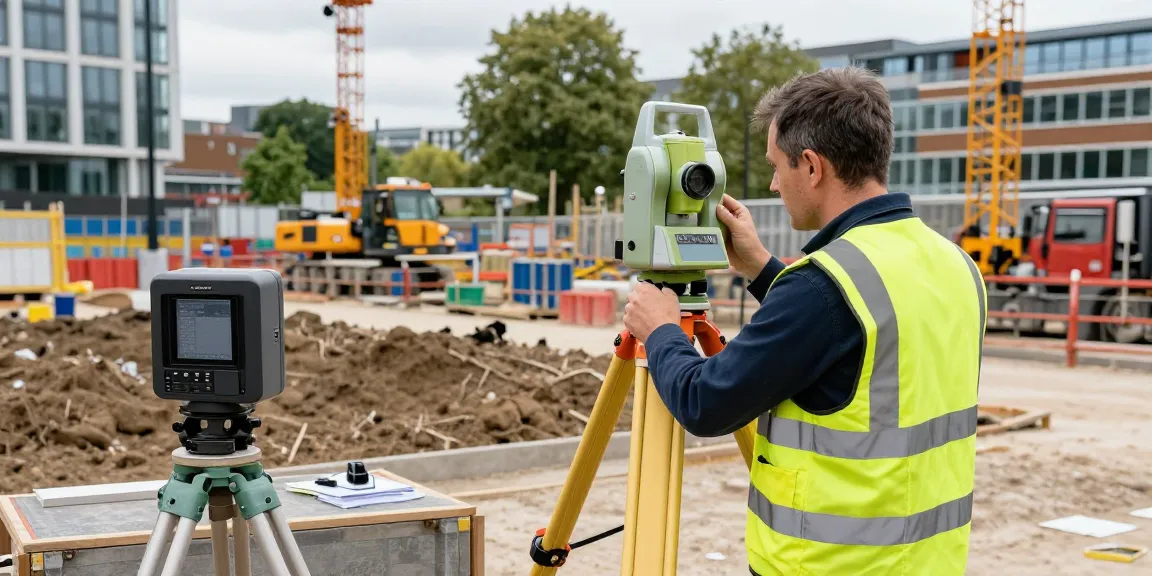
- Utilizing advanced equipment such as GPS, total stations, and laser scanners.
- Preparing detailed maps and reports for clients.
- Advising on land use based on survey findings.
- Ensuring compliance with local regulations and standards.
Importance in Construction and Development
Topographical surveys are crucial for any construction project. They provide essential information that influences the design and construction processes. By accurately detailing the terrain, these surveys help prevent costly errors, ensure safety, and facilitate smooth project execution. In addition, most local authorities require topographical surveys as part of the planning application process, making them a fundamental element of any successful development.
Benefits of Hiring Professional Land Surveyors
Engaging professional land surveyors offers several advantages that can make a significant impact on the outcome of a project. Their expertise ensures that measurements are accurate and complete, leading to better design and planning decisions.
Accuracy in Land Measurements
One of the primary benefits of hiring professional surveyors is their ability to provide precise measurements. Using state-of-the-art tools and techniques, land surveyors ensure that every detail is captured accurately. This level of precision is essential for creating structures that comply with regulations and meet design specifications.
Risk Mitigation and Safety Enhancements
Topographical surveys help identify potential hazards such as unstable ground or flood zones. By highlighting these risks during the planning stage, surveyors enable project managers to take preventive measures, ensuring the safety of both workers and future occupants of the built environment.
Support for Planning Applications
Local councils often mandate a topographical survey as part of the planning application process. By providing detailed insights into the land, surveyors support developers in demonstrating compliance with zoning laws and building codes, which is crucial for obtaining the necessary permits.
How to Choose the Right Surveyor for Your Project
Selecting the right surveyor for your project can significantly influence the success of your land development. A thorough selection process ensures that you find a professional who meets your specific needs and expectations.
Evaluating Qualifications and Experience
When searching for a land surveyor, start by evaluating their qualifications and professional experience. Look for certifications from recognized surveying institutions and inquire about their experience with similar projects. An experienced surveyor will have a track record of delivering accurate surveys and navigating complex situations.
Assessing Specialisations and Equipment Used
Surveying is a technical field, and different projects may require different specialisations. Assess whether a surveyor has experience in your specific area of interest, such as commercial developments, residential projects, or infrastructure work. Additionally, inquire about the equipment they use; modern tools like UAVs and 3D laser scanners can enhance the quality and accuracy of surveys.
Understanding Pricing Structures
Cost is always a consideration in project planning. When discussing expenses with potential surveyors, ensure you understand their pricing structures. Many surveyors offer fixed-price quotes that encompass all associated costs, ensuring there are no hidden fees. This clarity allows you to budget effectively for your project.
Technological Advancements in Land Surveying
The land surveying industry is rapidly evolving, driven by technological advancements that enhance accuracy and efficiency. Staying abreast of these developments is crucial for both surveyors and their clients.
Current Tools Used by London Land Surveyors
Modern land surveyors in London employ a range of sophisticated tools to carry out their work, including:
- GPS Surveying Equipment (GNSS): Provides accurate point positioning.
- Total Station Instruments: Combines theodolite and EDM technology for precise angle and distance measurements.
- 3D Laser Scanners (LiDAR): Captures millions of data points for detailed topographical mapping.
- UAVs (Drones): Used for aerial surveys of hard-to-reach areas.
- Digital Level Instruments: Essential for measuring vertical changes and ensuring survey accuracy.
Future Trends Shaping the Industry
As land surveying technology continues to advance, several key trends are emerging in the industry:
- Increased Use of Drones: Drones are becoming a standard tool for surveyors, providing aerial mapping capabilities that enhance data collection.
- Integration of GIS Technology: Geographic Information Systems (GIS) are now commonly integrated with surveying processes, enabling more sophisticated data analysis and visualisation.
- Real-Time Data Collection: The ability to gather data in real time allows for quicker decision-making and project adjustments.
Integration of GIS and Mapping Software
GIS technology and advanced mapping software are increasingly shaping the way surveyors work. By integrating these tools, surveyors can create detailed visualisations of projects, allowing stakeholders to better understand site conditions and potential challenges. This integration streamlines communication between surveyors, architects, and engineers, ensuring everyone is aligned throughout the project lifecycle.
Common Challenges Faced by Land Surveyors
Despite their expertise and advanced tools, land surveyors encounter a variety of challenges in their work. Understanding these obstacles can help clients appreciate the complexities of the surveying process.
Dealing with Complex Terrain
Many projects take place in areas with complex terrain, which can complicate data collection. Surveyors must adapt their techniques and tools to ensure accurate measurements in challenging environments, which can require additional planning and resources.
Regulatory Compliance and Planning Issues
Navigating local regulations and planning requirements can be a daunting task. Surveyors must stay informed about current laws and guidelines to ensure their surveys meet all necessary criteria. Failing to do so can lead to delays or complications in the permitting process.
Managing Client Expectations and Deliverables
Clear communication with clients regarding project timelines, expected outcomes, and any potential limitations is crucial. Land surveyors must manage both their own deliverables and the expectations of their clients to ensure a successful project outcome.
What is the cost of hiring a land surveyor?
The cost of hiring a land surveyor can vary widely based on several factors, including the complexity of the project, the size of the land, and the specific services required. Typically, smaller residential surveys may range from £450 to £750, while larger commercial projects could exceed £1,500. Obtaining detailed quotes from multiple surveyors can help you compare pricing effectively.
How long does a topographical survey take?
The duration of a topographical survey depends on the scope of the project and the size of the land being surveyed. Generally, simple surveys can be completed in a few days, while more complex projects may take several weeks. It’s essential to discuss timelines with your chosen surveyor to establish realistic expectations.
What equipment do London land surveyors use?
London land surveyors utilize a variety of advanced tools and technologies, including GPS equipment, total stations, 3D laser scanners, drones for aerial surveys, and digital levels. The choice of equipment often depends on the specifics of the job and the desired accuracy of the measurements.
Are land surveyors responsible for boundary disputes?
Land surveyors can play a key role in resolving boundary disputes by providing accurate measurements and evidence of property lines. However, while they can assist in clarifying boundaries, legal disputes may require additional involvement from legal professionals.
What are the advantages of drone surveying?
Drone surveying offers numerous advantages, including:
- Access to difficult terrain that may be challenging for ground surveys.
- Speedier data collection, allowing for quicker project turnaround.
- High-resolution aerial imagery for detailed site analysis.
- Cost-effectiveness for large-scale surveys compared to traditional methods.
In conclusion, hiring a professional land surveyor is essential for any successful construction or development project. Their expertise in topographical surveys and understanding of local regulations ensures that you have accurate, actionable data to guide your project from planning through execution.